Why You Should Diversify Your Navigation Skills

Showing posts with label Navigation. Show all posts
Showing posts with label Navigation. Show all posts
Waze Dangerous Intersection Warning

Waze Dangerous Intersection Warning
Waze does Waze not have a specific "dangerous intersection warning" feature? However, Waze does provide various safety alerts and notifications to drivers based on user-generated reports and real-time data. These alerts can include hazards, accidents, road closures, police presence, and other relevant information.
Waze relies on its community of users to report incidents and hazards they encounter on the road. If multiple users report a specific intersection as dangerous or hazardous, it is possible that Waze will take that into account and provide alerts or notifications to other drivers approaching that intersection.
Buying a Home In A Safe Neighborhood

Dangerous Intersection Ahead
If you are buying a home these days you should probably do your due diligence on dangerous intersections that are within a few blocks of your home. Especially if you have kids and these kids like to play outside and walk to school or around the neighborhood. Common sense would tell you that your local government should provide a map of these hazardous intersections and provide this data to Google Maps and other navigation sources. Does this happen? Off course it doesn't!!!
One of the biggest concerns of a prospective home buyer today is the safety of street and neighborhood. What kind of traffic on the street next to the home and is it safe to walk the streets and have my kids play outside. Most people don't often think of doing due diligence on historic accidents in the neighborhood or street. We have even done a map showing dangerous schools near hazardous intersections.
Most drivers are much more more distracted than they were 20 years ago and thus accidents and pedestrian fatalities have increase significantly. Here is an article about the top reasons that cause a dangerous intersection and another article about the top 10 causes of death among people ages 15-29.
It is not always transparent if you are new to a neighborhood if there have been historic problems with a particular intersection and its not easy to find news articles and get information. In fact, not all cities keep historic accident records and are required to publish the information for fear of liability. Public relations is a huge part of trying to squash any negative press about intersections that are "dangerous by design" because cities don't want the liability or lawsuit. Cities don't have fix problems unless they are forced to fix the issue with enough pressure.
Here is a person in Redondo Beach that won a lawsuit against the city for $27M because he proved the intersection was dangerous by design and the city did nothing to fix the problem.
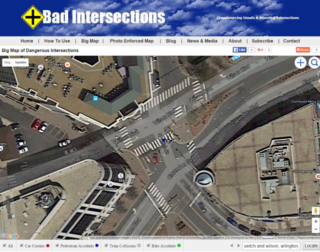
BadIntersections.com uses public news data sources and user contributions to map dangerous vehicle, pedestrian, bike and train intersections. We collect thousands of new fatalities and articles from around the World highlighting dangerous intersections. The map is free to search and can be found by clicking on the map below. If you see an intersection area that you would like us to add please email us an article or click on the + directly on the map to contribute the location. Keep in mind we do not accept all submissions unless the information is complete with substantiated evidence.

Map of Hazardous Intersections & Fatalities
We often get emails from real estate agents looking for data to help their clients better understand what dangerous intersections exists in the neighborhood near the home. This is often true of out of state buyers looking at homes who are unfamiliar with the area. Home buyers from out of the area often want to get a feel for the area without having to see the location first hand and want to know if a particular home or apartment is near any hazards.
Badintersectionscom is actively trying to dangerous intersection locations used by real estate companies like Zillow, RedFin & Realtor.com. We think hazardous road location data should be an attribute used by real estate companies similar to how Walkscore provides a information about things nearby a home like schools, restaurants and parks.
Most real estate companies have been very reluctant to share this data with prospective home buyers for obvious reasons. Why would any real estate agent want to give a reason NOT to buy a home? Hopefully, this culture of dishonesty will change in the near future and this data can provide some transparency.
Google Maps Suggest Illegal Left Hand Turn
 |
| No Left-Hand Turn at Harlem and West 56th in Summit, Illinois |
Watch Engadget Car Tech Talk at Live at CES 2017

— jeffcohn (@jeffcohn) January 5, 2017Here is a summary of the CES 2017 panel video below.
Both Honda Nuvis and Concept-I Toyota cars have artificial intelligence (AI) that measures your mood. They say its your friend or assistant to help you understand what you might need. A new route home or even some mood music.
Faraday Future also has a mood feature in the car as well. However, there are rumors that the company is in financial difficulty not paying bills and executives leaving.
Cars will now have multiple modems in the car to use multiple wireless carriers when coverage stinks.
Hyundai is testing an autonomous car at CES and the one of the people on stage had a close call with a truck on the road.
Waze warns you about dangerous intersections in 5 big US cities
 |
| Waze Dangerous Intersection |
Waze thinks it can help. It's now alerting drivers in five big US cities (Boston, Los Angeles, New York, San Francisco and Washington) when they approach intersections with the historically high crash and injury rates -- get close to one of these danger zones and you'll get a reminder to drive carefully. This won't do anything to stop other drivers from ruining your day, but it should prepare you for the dangers ahead. Read more
This comment below is particularly interesting to me . . .

United States Dangerous Intersections Map

Bad Intersections is a crowdsourced map database of intersections that are unsafe and annoying. Our mission is to identify hazardous intersections for pedestrians, cyclists, and drivers. Our goal is to identify intersections with the following characteristics: lots of accidents (vehicles, bikes, pedestrians), confusing driver navigation, long lights, congestion, traffic jams. driving. Search our map at BadIntersections.com.